
Phases 1 and 2 of this project are funded by the Australian Government ($900,000). Australian Government funding is provided through the National Water Grid Fund.
This study will help to refine existing groundwater and surface water models.
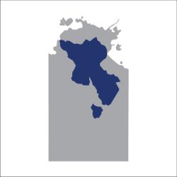
Project overview
This desktop study will update existing ground and surface water models. Modelling is a key tool used in water resource planning and allocation decisions. They replicate surface water and groundwater processes and predict the possible effects of resource development on water resources.
Updated models increase the certainty on the amount of water that can be used for agricultural developments. They also provide information on the amount that should be kept for the environment or cultural requirements. This will assist in strengthening water security in the region.
Goals of the assessment
This project aims to update existing water resource models. It focuses on updating models in high-demand water systems. This enables the Northern Territory (NT) Government to:
- improve the predictive capability of the models
- enhance certainty on environmentally sustainable yields
- identify water available for allocation
- increase supply assurance to large agricultural projects.
Environmental and cultural considerations
Sustainable extraction limits determine how much water the environment needs, for current and future use. The project aims to improve our understanding of these limits. It also provides information on how much can be sustainably used for other purposes. This includes for economic uses, such as supporting business.
Phase 1
Phase 1 of the project has been successfully completed. Key existing groundwater models have been updated with new data. These models capture the:
- Flora River
- Oolloo Dolostone / Lower Daly
- Daly-Roper-Beetaloo
- Western Davenport Plains.
The new models include updated climate trends, hydrostratigraphic information and enhanced spatial datasets.
Project outcomes also complement the work undertaken as part of the ‘LiDAR survey and digital elevation model development for key NT rivers’ project.
Phase 2
Phase 2 of the project has commenced. It will focus on updating models for 3 major underground aquifer systems:
- Ti Tree Paleochannel and Berry Springs Dolostone aquifers – the main community water supply for the region. It is also the single source of water supply for stock, horticulture and domestic water use.
- Koolpinyah Dolostone Aquifer – the sole source of water for Darwin’s rural residential areas. It is also used by communities who do not have access to reticulated water.
The Northern Territory Government also contributing $110,000 through in-kind contributions* for this phase.
*In-kind contributions are contributions of goods and services and do not contribute to the total project cost.
Key project benefits
Learn more
- Learn more about our Science Program.
- Project: Water accountability, metering and reporting framework review.
- Project: Integrated surface and groundwater assessment on the Roper River catchment in the Northern Territory.
- Project: Phase 1 and 2: LiDAR survey and digital elevation model development for key Northern Territory rivers