This project is funded by the Australian Government ($5.2 million). Australian Government funding is provided through the National Water Grid Fund.

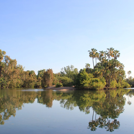
The Roper River is a large, perennial flowing river in the northeast of the Northern Territory. Image credit: Marcus Barber, CSIRO.
Project overview
Water resource assessments provide information to help understand the benefits and constraints of water development and infrastructure decisions. This is especially important for considering further development in northern Australia.
With funding from our Science Program, CSIRO has conducted a water resource assessment in the Roper River, Northern Territory (NT). They worked with the Northern Territory Government, research partners and communities. This assessment was undertaken alongside similar assessments for the Victoria River and Southern Gulf catchments. These assessments build on previous assessments from the Northern Australian Water Resources Assessment (NAWRA) project. The NAWRA project was funded by the Australian Government.
Goals of the assessment
Most rivers in northern Australia are unregulated. Current surface and groundwater allocations are small. Understanding what and where these resources are will support decisions on further development. The impacts of extracting water will also be identified. They also identify the types of development and associated risks. Indigenous rights, values and development aspirations are also included in assessments.
The assessment aimed to:
- fill knowledge and data gaps on soil and water resources across the north of Australia including:
- water availability
- land suitability
- existing uses
- impacts of different types of development
- scales of extraction
- identify and evaluate water capture and storage options
- assess commercial viability of irrigated agriculture and aquaculture opportunities
- provide a long-term knowledge base and legacy datasets.
The research will support broader Australian Government investment and policy decisions on developing northern Australia. It will also help support state and territory government water planning. It will assist the development of updated water resource plans to support more sustainable water allocation decisions and use in the region.
Environmental and cultural considerations
The assessment included key activities to ensure environmental, social and cultural impacts were considered. Activities included:
- identifying First Nations Peoples’ aspirations and water values
- understanding trade-offs between water resource development and impacts on ecosystems, including freshwater species and habitats as well as coastal marine habitats that could be affected by changes in run-off.
Key outcomes from the assessment
The Assessment found:
- The soils and climate of the Roper Catchment are suitable for a wide range of annual and perennial horticulture and broadacre crops and forages.
- The physical attributes of the catchment are such that it is possible to increase the area of land under irrigation from 0.02% to 0.7% using either surface water or groundwater.
- The regions in the catchment with the greatest potential for irrigated agriculture are the ‘riverless’ Sturt Plateau in the south-west of the catchment, and the alluvial clay soils found on river frontages along the Roper River and its major tributaries.
- The actual scale of potential development would heavily depend on community, government, and Traditional Owners acceptance of potential changes, including to groundwater-dependent ecosystems, springs, vegetation, and the river itself.
About the Roper River
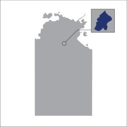
The Roper River is a large perennial river located in the Katherine region of the NT. It is the NT’s second largest river, with a basin size of 81,794km2. The Roper River’s headwaters extend northwards right up into Arnhem Land and south into the drier area of the Beetaloo Basin. The Roper River is rich in cultural history and is protected in the Limmen Marine Park and Limmen National Park.
Technical statement
This statement is made by the Australian Government Department of Climate Change, Energy, the Environment and Water and the Department of Environment, Parks and Water Security, Northern Territory.
The Roper River Water Resource Assessment provides a comprehensive and integrated evaluation of the feasibility, economic viability and sustainability of water and agricultural development in the Roper River Catchment. While the Assessment indicates that development is potentially feasible in some areas, site specific assessments will be needed to determine proposal viability and regulatory requirements. The independent assessment was undertaken by CSIRO.
Should a development be planned, please reach out to both national and Northern Territory departments to ensure compliance with current legislative and policy requirements. Australia has strong laws in place to protect our environment and meet our international obligations. Australia’s national environmental law, the Environment Protection and Biodiversity Conservation Act 1999 (EPBC Act), protects matters of national environmental significance. These include world heritage areas, national heritage places and listed threatened species and ecological communities, among others.
Public consultation is a fundamental part of the assessment process, including engagement with First Nations communities through the Engage Early Guidelines. Further information is available at Environment Protection and Biodiversity Conservation Act 1999 (EPBC Act).
The legislative and regulatory context in the Northern Territory reflects its unique environment and developing economy, with established processes that recognise Aboriginal sacred sites, land tenure arrangements and to protect environmental and ecological functions.
Under the Northern Territory Water Act 1992, a draft water allocation plan has been developed for Mataranka, which was informed by the Water Advisory Committee. The draft plan maintains more than 90% of the base dry season flows in the Roper River.
Further information is available on the Northern Territory government website:

